Exploring the Ohio: Map, History, and Ecology
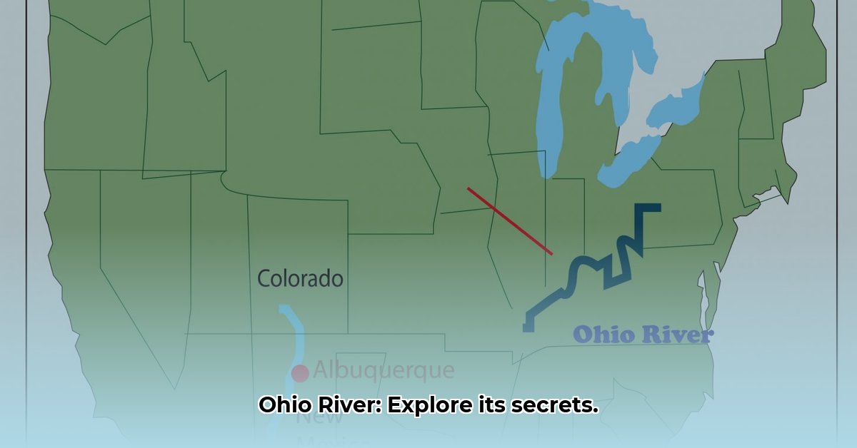
The Ohio River isn’t just a line on a map; it’s a 981-mile (1,579 km) artery pumping life through the heart of America. From its origins in Pittsburgh, Pennsylvania, where the Allegheny and Monongahela Rivers converge, it charts a southwestern course, ultimately joining the Mississippi River at Cairo, Illinois. This dynamic waterway has shaped communities, economies, and ecosystems, leaving an indelible mark on the American landscape. This article will explore the river’s geographical context, its rich history, its ecological significance, and the challenges it faces today.
The River’s Course: A Geographic Overview
The Ohio River forms a natural border, separating Ohio from West Virginia and Kentucky, and Indiana from Kentucky. Its influence extends further, touching portions of Pennsylvania, Illinois, and several other states. Major cities like Pittsburgh, Cincinnati, Louisville, and Evansville owe their locations, and much of their prosperity, to the river. These urban centers have served as vital ports and transportation hubs throughout history, their fates intertwined with the river’s flow.
To pinpoint the Ohio’s journey, its source in Pittsburgh lies approximately at 40°26′30″N 80°00′47″W. From there, it carves a 981-mile path through valleys and hills, shaped by ancient geological forces, until it reaches the Mississippi near Cairo, Illinois (around 37°10′35″N 89°10′29″W).
The Ohio River Basin: A Wider Perspective
The Ohio River Basin encompasses much more than the river itself. Imagine the entire land area that drains into the Ohio—that’s the basin. This vast area spans parts of fourteen states, a testament to the river’s far-reaching impact. Within this basin, a complex web of tributaries feeds into the main channel, each with its own story to tell. The Wabash, Cumberland, and Tennessee Rivers are just a few of the major tributaries that contribute to the Ohio’s flow. Researchers suggest these tributaries play a crucial role in the overall health and biodiversity of the Ohio River ecosystem, impacting everything from fish populations to water quality.
Key Features and Tributaries: A Closer Look
The Ohio River’s journey isn’t solitary; it’s a confluence of many waterways. Born from the union of the Allegheny and Monongahela Rivers in Pittsburgh, the Ohio gains momentum and character as it gathers the flow of numerous tributaries along its course. These tributaries, including the Kanawha, Scioto, Miami, Wabash, Tennessee, Cumberland, Green, and Kentucky Rivers, enrich the Ohio’s waters and contribute to its vibrant ecosystem.
| Tributary | Length (miles) | Location | Notes |
|---|---|---|---|
| Allegheny River | ~325 | Pennsylvania, New York | One of the two main rivers forming the Ohio. |
| Monongahela River | ~130 | West Virginia, Pennsylvania | The other major river contributing to the Ohio’s formation. |
| Kanawha River | ~97 | West Virginia | Known for its scenic beauty and recreational opportunities. |
| Scioto River | ~231 | Ohio | Flows through Columbus, the state capital. |
| Miami River | ~161 | Ohio | Important for industry and agriculture in western Ohio. |
| Wabash River | ~475 | Indiana, Illinois | Forms part of the boundary between Indiana and Illinois. |
| Tennessee River | ~652 | Tennessee, Alabama, Kentucky, Mississippi | The Ohio River’s largest tributary by volume. |
| Cumberland River | ~688 | Kentucky, Tennessee | Plays a significant role in regional flood control. |
| Green River | ~384 | Kentucky | Known for its Mammoth Cave system. |
| Kentucky River | ~259 | Kentucky | A significant waterway within the state. |
Human intervention has also shaped the river. Dams and locks, built to control flooding and facilitate navigation, are feats of engineering. However, studies are ongoing to determine their long-term environmental consequences. Some research suggests that these structures may impact sediment flow, fish migration, and the overall health of the river ecosystem.
Beyond its industrial role, the Ohio River offers recreational opportunities and natural beauty. The Ohio River Islands National Wildlife Refuge provides sanctuary for various plant and animal species. The Falls of the Ohio State Park, with its exposed fossil beds, offers a glimpse into prehistoric life. Numerous historical sites and museums dot the riverbanks, inviting exploration and a deeper understanding of the region’s past.
A River Through Time: History and Ecology
The Ohio River’s history is a tapestry woven with human stories and ecological transformations. Long before modern transportation, the river was a primary route for westward expansion, a vital artery for commerce, and a symbolic dividing line between North and South. It played a critical role in the Underground Railroad, offering a pathway to freedom for those escaping slavery.
The river’s ecological story is equally compelling. Its wetlands act as natural filters, purifying the water and supporting a diverse ecosystem. However, this delicate balance faces pressures from industrial development and pollution. Ongoing conservation initiatives offer hope for restoring the river’s health and preserving its biodiversity for future generations. Organizations like the Ohio River Foundation and the Ohio River Valley Water Sanitation Commission (ORSANCO) are actively involved in monitoring water quality, promoting sustainable practices, and educating the public about the river’s importance.
Before European arrival, the Ohio River held profound significance for Indigenous peoples. Tribes like the Shawnee, Miami, and Osage depended on it for sustenance, transportation, and spiritual connection. Their history is inseparable from the river’s narrative, a testament to the enduring bond between humans and nature. Ongoing archaeological discoveries continue to reveal insights into the rich cultural heritage of these Native American tribes and their intimate relationship with the Ohio River. Some researchers suggest that certain river bends and confluences held particular spiritual significance, adding another layer of complexity to our understanding of the river’s past.
Today, interactive maps and digital resources offer powerful tools for exploring the Ohio River’s multi-faceted history. These platforms allow users to visualize the river’s course, uncover ecological data, and learn about the impacts of human activity. They provide a dynamic and engaging way to connect with the river’s past, present, and future.
The Future of the Ohio: Ongoing Research and Challenges
While we know much about the Ohio River, there’s still much to discover. Ongoing research continues to refine our understanding of the river’s complex dynamics, from its geological history and ecological processes to the impact of human activities. Scientists are studying the river’s water quality, seeking sustainable resource management strategies, and investigating the potential effects of climate change. The river’s role in transportation and commerce is also likely to evolve, influenced by technological advancements and shifting economic landscapes. Debates continue regarding the best approaches to protect the river’s biodiversity, address pollution, and mitigate habitat loss. These are just some of the areas where active research and discussion are shaping our understanding of the Ohio River and its future.
The Ohio River, captured on a map and explored through its history and ecological significance, is a powerful reminder of the interconnectedness of nature, human history, and the ongoing challenges of environmental stewardship.